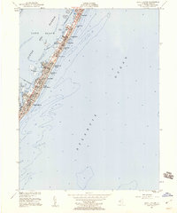
1951 Map of Beach Haven
USGS Topo · Published 1960About this map
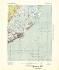
Long Beach island exhibits a dense string of mid-century coastal developments on this 1951 survey, situated between the Atlantic Ocean and the sheltered waters of Little Egg Harbor. The map captures a period of significant residential expansion, with established communities like Beach Haven, Brant Beach, and Beach Haven Terrace showing an intricate grid of streets and structures. The Intracoastal Waterway snakes through the harbor, passing landmarks such as Harris Harbor and the Marshelder Islands. This coastal landscape is defined by its precarious geography, with small landmasses like Daniel Island, Sand Island, and the Mordecai Islands buffering the main barrier island from the bay. The map reflects a moment when the Jersey Shore's infrastructure was maturing, evidenced by the inclusion of modern utilities like the Sewage Disposal plant and the clearly defined Boro Boundary.
Find a feature on this map
26 named features on this map. Tap any name to fly to it.
Don’t see what you’re looking for? This feature index may not catch every label — zoom into the map to look around manually.
Map Details
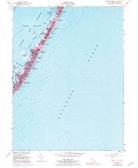
Editions of this 1951 Beach Haven Map
4 editions found
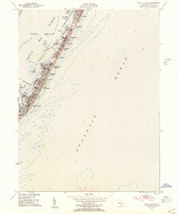
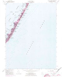
Other maps of this area

1887 · Atlantic City
USGS Topo · 1:62,500

1888 · Little Egg Harbor
USGS Topo · 1:62,500

1888 · Long Beach
USGS Topo · 1:62,500

1893 · Little Egg Harbor
USGS Topo · 1:62,500

1893 · Long Beach
USGS Topo · 1:62,500

1894 · Atlantic City
USGS Topo · 1:62,500

1919 · Long Beach
USGS Topo · 1:62,500

1920 · Little Egg Harbor
USGS Topo · 1:62,500

1940 · Atlantic City
USGS Topo · 1:62,500
1941 · Atlantic City
USGS Topo · 1:62,500