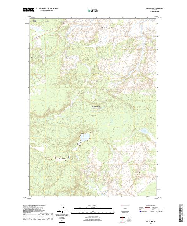
2021 Map of Beach Lake
USGS Topo · Published 2021About this map
Yellowstone National Park terrain dominates this survey of the high plateau country within Teton and Park counties. The topography is defined by the Central Plateau and the broad opening of Hayden Valley to the northeast, where thermal activity is evidenced by Highland Hot Springs. Hydrological patterns show numerous drainage systems originating near the continental divide, including Alum Cr, Trout Cr, and Arnica Cr. These waters converge near significant alpine bodies like Beach Lake and the smaller Dryad Lake. The historical route of the Mary Mountain-Nez Perce Trl traverses the north, crossing Nez Perce Cr near the prominent rise of Mary Mtn. The map captures the specialized geography of the park's interior, where ancient trails follow natural corridors through a landscape of geothermal features and high-altitude valleys.
Find a feature on this map
20 named features on this map. Tap any name to fly to it.
Don’t see what you’re looking for? This feature index may not catch every label — zoom into the map to look around manually.
Map Details
Editions of this 2021 Beach Lake Map
This is the sole edition of this map. No revisions or reprints were ever made.
Other maps of this area

1885 · Lake
USGS Topo · 1:125,000

1885 · Gallatin
USGS Topo · 1:125,000

1885 · Gallatin
USGS Topo · 1:125,000

1886 · Shoshone
USGS Topo · 1:125,000

1886 · Canyon
USGS Topo · 1:125,000

1888 · Shoshone
USGS Topo · 1:125,000

1895 · Shoshone
USGS Topo · 1:125,000

1895 · Canyon
USGS Topo · 1:125,000

1895 · Lake
USGS Topo · 1:125,000

1896 · Lake
USGS Topo · 1:125,000