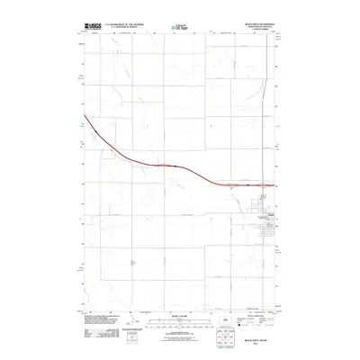
2011 Map of Beach West
USGS Topo · Published 2011About this map
Beach sits on the western edge of the North Dakota prairie, serving as a gateway between the high plains and the surrounding badlands. This 2011 survey captures the town’s established infrastructure, including the Beach Rural Fire Dept and several fire protection facilities that safeguard the local community. The landscape is defined by the drainage systems of Hay Creek and Yates Creek, which carve through the grid of agricultural section lines. Historically significant extraction is noted at the Black Diamond Mine, located south of the main settlement. The transportation network is anchored by the presence of Yates, a siding or junction along the rail and road corridor, and a system of county roads such as Carlyle Rd and Black Diamond Rd that facilitate the movement of goods and agricultural products across the county.
Find a feature on this map
26 named features on this map. Tap any name to fly to it.
Don’t see what you’re looking for? This feature index may not catch every label — zoom into the map to look around manually.
Map Details
Editions of this 2011 Beach West Map
This is the sole edition of this map. No revisions or reprints were ever made.
Other maps of this area

1909 · Glendive
USGS Topo · 1:250,000

1953 · Miles City
USGS Topo · 1:250,000

1953 · Dickinson
USGS Topo · 1:250,000

1953 · Watford City
USGS Topo · 1:250,000

1954 · Glendive
USGS Topo · 1:250,000

1957 · Dickinson
USGS Topo · 1:250,000

1957 · Miles City
USGS Topo · 1:250,000

1957 · Glendive
USGS Topo · 1:250,000

1957 · Watford City
USGS Topo · 1:250,000

1958 · Miles City
USGS Topo · 1:250,000