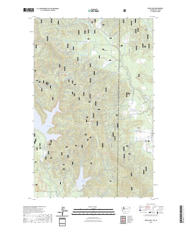
2023 Map of Bead Lake
USGS Topo · Published 2023About this map
Kaniksu National Forest defines this high-elevation borderland where the Washington and Idaho state line meets the Pend Oreille and Bonner county divide. The landscape is dominated by the sprawling waters of Bead Lake and Marshall Lake, which serve as significant landmarks in a terrain characterized by ridges like Bead Lake Peak and Mosquito Point. Remote airstrips such as Valenov Ranch Airport and the winter recreation area of Snow Valley indicate the modern land use of these timbered hills, which remain largely accessible only via forest service routes like Bead Lake Rd and Ojibway Rd. The intricate drainage network is anchored by the Lower West Branch Priest River, which flows through the northeastern corner, fed by numerous seasonal streams including Butch Creek, Bear Paw Creek, and South Ole Creek.
Find a feature on this map
46 named features on this map. Tap any name to fly to it.
Don’t see what you’re looking for? This feature index may not catch every label — zoom into the map to look around manually.
Map Details
Editions of this 2023 Bead Lake Map
This is the sole edition of this map. No revisions or reprints were ever made.
Other maps of this area

1901 · Sandpoint
USGS Topo · 1:125,000

1911 · Priest Lake
USGS Topo · 1:250,000

1911 · Sandpoint
USGS Topo · 1:125,000

1913 · Priest Lake
USGS Topo · 1:250,000

1936 · Newport
USGS Topo · 1:96,000

1942 · Newport
USGS Topo · 1:125,000

1958 · Sandpoint
USGS Topo · 1:250,000

1963 · Sandpoint
USGS Topo · 1:250,000

1967 · Quartz Mtn
USGS Topo · 1:24,000
1967 · Outlet Bay
USGS Topo · 1:24,000