
1967 Map of Quartz Mtn
USGS Topo · Published 1971About this map
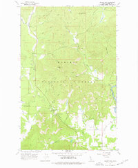
Kaniksu National Forest dominates this mid-century topographic study, where the steep ridgelines of Quartz Mtn and Jasper Mtn define a terrain of dense drainages and scattered resource extraction. The area’s administrative and logistical center is found at the Falls Ranger Station, situated near the confluence of the Lower West Branch and the Priest River. A network of pack trails and jeep trails crisscrosses the landscape, linking remote landmarks like Cottonwood Point and the open ground of Daggett Meadow.
Find a feature on this map
32 named features on this map. Tap any name to fly to it.
Don’t see what you’re looking for? This feature index may not catch every label — zoom into the map to look around manually.
Map Details
Editions of this 1967 Quartz Mtn Map
2 editions found
Other maps of this area

1901 · Sandpoint
USGS Topo · 1:125,000

1911 · Priest Lake
USGS Topo · 1:250,000

1911 · Sandpoint
USGS Topo · 1:125,000

1913 · Priest Lake
USGS Topo · 1:250,000

1936 · Newport
USGS Topo · 1:96,000

1942 · Newport
USGS Topo · 1:125,000

1958 · Sandpoint
USGS Topo · 1:250,000

1963 · Sandpoint
USGS Topo · 1:250,000

1967 · Coolin
USGS Topo · 1:24,000
1967 · Outlet Bay
USGS Topo · 1:24,000