1967 Map of Coolin
USGS Topo · Published 1971About this map
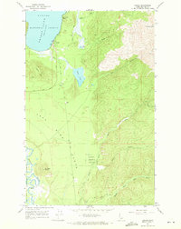
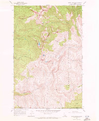
Coolin and the shoreline of Priest Lake serve as the focal points of this 1967 survey of northern Idaho. The settlement at Sherwood Beach sits just north of the village, connected by the East Shore Road which follows the water's edge. To the east, the landscape rises toward Sundance Mtn, with a series of smaller water bodies including Lee Lake and Chase Lake tucked into the drainage of Chase Creek. A network of gravel pits and primitive roads suggests the local resource-based economy and early development of this timbered region. Further south, the terrain levels into the broad Jack Pine Flats where the Priest River meanders in tight oxbows. This map documents a period of transition as seasonal recreation and forest management defined the use of the Kaniksu National Forest.
Find a feature on this map
22 named features on this map. Tap any name to fly to it.
Don’t see what you’re looking for? This feature index may not catch every label — zoom into the map to look around manually.
Map Details
Editions of this 1967 Coolin Map
This is the sole edition of this map. No revisions or reprints were ever made.
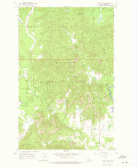
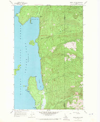
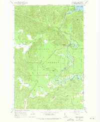
Other maps of this area

1901 · Sandpoint
USGS Topo · 1:125,000

1911 · Priest Lake
USGS Topo · 1:250,000

1911 · Sandpoint
USGS Topo · 1:125,000

1913 · Priest Lake
USGS Topo · 1:250,000

1958 · Sandpoint
USGS Topo · 1:250,000

1963 · Sandpoint
USGS Topo · 1:250,000
1967 · Quartz Mtn
USGS Topo · 1:24,000
1967 · Priest Lake SE
USGS Topo · 1:24,000
1967 · Outlet Bay
USGS Topo · 1:24,000
1967 · Mount Roothaan
USGS Topo · 1:24,000