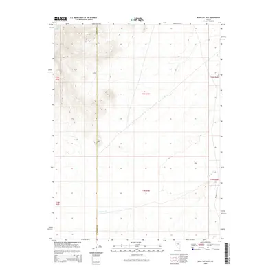
2014 Map of Bean Flat West
USGS Topo · Published 2014About this map
Bean Flat occupies the low-lying eastern portion of this high-desert landscape on the border of Lander and Eureka Counties. The terrain is defined by dramatic elevation changes, with the northern heights broken by Flat Canyon and a prominent landform known simply as The Point. This 2014 survey records a remote segment of the Great Basin where water sources like Dickenson Spring and Stoneberger Cr dictate the movement of both wildlife and local commerce. The presence of William Creek Ranch Rd in the southeastern corner provides the primary modern access point to these interior basins, which remain largely undeveloped and structured by the traditional Public Land Survey System grids of t20n r48e and surrounding townships.
Find a feature on this map
13 named features on this map. Tap any name to fly to it.
Don’t see what you’re looking for? This feature index may not catch every label — zoom into the map to look around manually.
Map Details
Editions of this 2014 Bean Flat West Map
This is the sole edition of this map. No revisions or reprints were ever made.
Other maps of this area

1926 · Roberts Mountains
USGS Topo · 1:250,000

1929 · Roberts Mountains
USGS Topo · 1:250,000

1955 · Millett
USGS Topo · 1:250,000

1956 · Bartine Ranch
USGS Topo · 1:62,500

1956 · Antelope Peak
USGS Topo · 1:62,500

1956 · Ackerman Canyon
USGS Topo · 1:62,500

1959 · Millett
USGS Topo · 1:250,000

1960 · Hickison Summit
USGS Topo · 1:62,500

1978 · Summit Mountain
USGS Topo · 1:100,000

1979 · Simpson Park Mtns
USGS Topo · 1:100,000