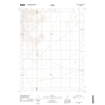
2018 Map of Bean Flat West
USGS Topo · Published 2018About this map
Bean Flat and the surrounding high-desert terrain of central Nevada are documented here along the shared boundary of Lander and Eureka counties. The landscape is defined by the sharp transition from the dry basin floor up into the steep relief of the Toiyabe Range, where Flat Canyon cuts into the northern highlands. Water resources in this arid environment are sparse but significant, centered on the perennial flow of Stoneberger Cr and the localized output of Dickenson Spring in the northwest. This 2018 survey reveals a territory primarily shaped by public land management and natural topography rather than dense settlement, with The Point serving as a prominent geographical landmark overlooking the flats below.
Find a feature on this map
12 named features on this map. Tap any name to fly to it.
Don’t see what you’re looking for? This feature index may not catch every label — zoom into the map to look around manually.
Map Details
Editions of this 2018 Bean Flat West Map
This is the sole edition of this map. No revisions or reprints were ever made.
Other maps of this area

1926 · Roberts Mountains
USGS Topo · 1:250,000

1929 · Roberts Mountains
USGS Topo · 1:250,000

1955 · Millett
USGS Topo · 1:250,000

1956 · Bartine Ranch
USGS Topo · 1:62,500

1956 · Antelope Peak
USGS Topo · 1:62,500

1956 · Ackerman Canyon
USGS Topo · 1:62,500

1959 · Millett
USGS Topo · 1:250,000

1960 · Hickison Summit
USGS Topo · 1:62,500

1978 · Summit Mountain
USGS Topo · 1:100,000

1979 · Simpson Park Mtns
USGS Topo · 1:100,000