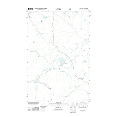
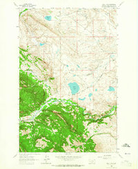
2011 Map of Bean Lake
USGS Topo · Published 2011About this map
Bean Lake serves as a central landmark in this high-plains landscape, where the Dearborn River cuts through the terrain of Lewis and Clark County. This 2011 survey illustrates a region defined by extensive ranching operations and water management, featuring historic properties like White Ranch, Mosher Ranch, and the Diamond Bar X Ranch. The infrastructure of the area is heavily tied to the movement of water through the Dearborn Canal, Mosher Ditch, and Cuniff Ditch, supporting the agricultural life of the basin. Recreational and topographical features are also prominent, from the Bean Lake Campground near the Bean Lake Dam to the distinctive heights of Table Mountain and Harrison Basin Ridge. The crossing at Dearborn River High Bridge highlights the critical transit points over the winding river system that shapes the local geography.
Find a feature on this map
38 named features on this map. Tap any name to fly to it.
Don’t see what you’re looking for? This feature index may not catch every label — zoom into the map to look around manually.
Map Details
Editions of this 2011 Bean Lake Map
This is the sole edition of this map. No revisions or reprints were ever made.
Other maps of this area

1903 · Coopers Lake
USGS Topo · 1:125,000

1943 · Hogan
USGS Topo · 1:125,000

1955 · Choteau
USGS Topo · 1:250,000

1957 · Choteau
USGS Topo · 1:250,000

1958 · Choteau
USGS Topo · 1:250,000

1962 · Choteau
USGS Topo · 1:250,000
1962 · Johnson Mountain
USGS Topo · 1:24,000
1963 · Blowout Mountain
USGS Topo · 1:24,000
1963 · Augusta
USGS Topo · 1:24,000
1963 · Bean Lake
USGS Topo · 1:24,000