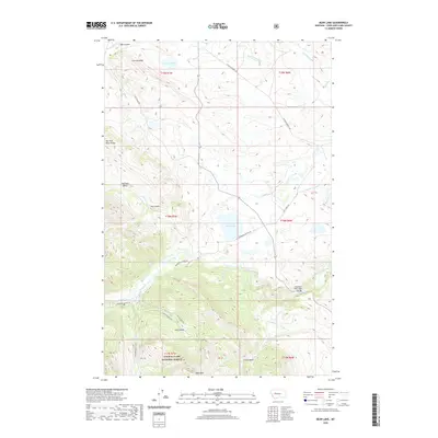
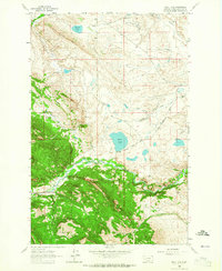
2020 Map of Bean Lake
USGS Topo · Published 2020About this map
Bean Lake lies at the center of this Montana landscape, where the prairie begins to meet the rising elevations of the Rocky Mountain Front. The Dearborn River winds through the southern half of the quadrangle, crossed by the Dearborn River High Bridge, a notable landmark for those navigating the transition between the plains and the forest. A significant portion of the southwestern corner is protected as part of the Lewis & Clark National Forest, anchored by the prominent heights of Table Mtn. This area is characterized by its complex water management system, including the Dearborn Canal, Carmichael Ditch, and Cuniff Ditch, which reflect the region's agricultural reliance on redirected water. Named basins such as Harrison Basin, Joslin Basin, and Cuniff Basin indicate a topography of natural depressions and valleys that have long shaped local land use and grazing patterns.
Find a feature on this map
40 named features on this map. Tap any name to fly to it.
Don’t see what you’re looking for? This feature index may not catch every label — zoom into the map to look around manually.
Map Details
Editions of this 2020 Bean Lake Map
This is the sole edition of this map. No revisions or reprints were ever made.
Other maps of this area

1903 · Coopers Lake
USGS Topo · 1:125,000

1943 · Hogan
USGS Topo · 1:125,000

1955 · Choteau
USGS Topo · 1:250,000

1957 · Choteau
USGS Topo · 1:250,000

1958 · Choteau
USGS Topo · 1:250,000

1962 · Choteau
USGS Topo · 1:250,000
1962 · Johnson Mountain
USGS Topo · 1:24,000
1963 · Blowout Mountain
USGS Topo · 1:24,000
1963 · Augusta
USGS Topo · 1:24,000
1963 · Bean Lake
USGS Topo · 1:24,000