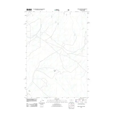
2011 Map of Bear Canyon
USGS Topo · Published 2011About this map
Bear Canyon and the surrounding drainage network of the Bighorn Basin define this landscape along the border of Montana and Wyoming. The map depicts a rugged area primarily characterized by water management and access routes, notably the Frannie Canal which cuts through the southwestern corner. The hydrology is dominated by Bear Creek, which winds through the center of the sheet, supported by the Southside Detention Dam and several intermittent tributaries like Piney Creek and Dry Creek. Human impact is visible through specialized infrastructure such as the Stockman Trl, reflecting the region's agricultural and ranching foundations. This 2011 survey provides clear evidence of how topographic features dictate road placement, with Bear Canyon Rd following the natural contours of the basin.
Find a feature on this map
8 named features on this map. Tap any name to fly to it.
Don’t see what you’re looking for? This feature index may not catch every label — zoom into the map to look around manually.
Map Details
Editions of this 2011 Bear Canyon Map
This is the sole edition of this map. No revisions or reprints were ever made.
Other maps of this area

1954 · Billings
USGS Topo · 1:250,000

1955 · Cody
USGS Topo · 1:250,000

1957 · Billings
USGS Topo · 1:250,000

1958 · Billings
USGS Topo · 1:250,000

1958 · Cody
USGS Topo · 1:250,000

1962 · Cody
USGS Topo · 1:250,000

1964 · Big Ice Cave
USGS Topo · 1:24,000

1964 · Red Pryor Mountain
USGS Topo · 1:24,000

1966 · Frannie
USGS Topo · 1:24,000

1966 · Cowley
USGS Topo · 1:24,000