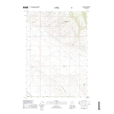
2020 Map of Bear Canyon
USGS Topo · Published 2020About this map
Custer National Forest encompasses the northern portion of this landscape, where the high-elevation terrain of Bear Canyon Ridge transitions into deep drainage systems. The map documents a rugged network of watercourses including Bear Cr, Piney Cr, and Dry Cr, which define the local topography alongside features like Cottonwood Coulee. This 2020 survey reveals a land primarily utilized for its natural resources and passage, evidenced by the presence of Petroglyph Canyon in the southeast. Movement through the area is facilitated by historic paths like the Stockman Trail and Graham Trail, alongside industrial infrastructure such as Helt Rd and Gyp Springs Rd, the latter suggesting a history of gypsum extraction or spring access in this border region between Wyoming and Montana.
Find a feature on this map
23 named features on this map. Tap any name to fly to it.
Don’t see what you’re looking for? This feature index may not catch every label — zoom into the map to look around manually.
Map Details
Editions of this 2020 Bear Canyon Map
This is the sole edition of this map. No revisions or reprints were ever made.
Other maps of this area

1954 · Billings
USGS Topo · 1:250,000

1955 · Cody
USGS Topo · 1:250,000

1957 · Billings
USGS Topo · 1:250,000

1958 · Billings
USGS Topo · 1:250,000

1958 · Cody
USGS Topo · 1:250,000

1962 · Cody
USGS Topo · 1:250,000

1964 · Big Ice Cave
USGS Topo · 1:24,000

1964 · Red Pryor Mountain
USGS Topo · 1:24,000

1966 · Frannie
USGS Topo · 1:24,000

1966 · Cowley
USGS Topo · 1:24,000