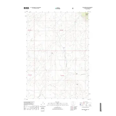
2018 Map of Bear Creek Ranch
USGS Topo · Published 2018About this map
Bighorn National Forest borders the northeastern corner of this Big Horn County landscape, where the high desert terrain transitions into the foothills. The area is defined by its drainage systems, notably Dry Bear Cr and Bear Cr, which provide the lifeblood for isolated outposts like the Bear Creek Ranch. The presence of the Lampman Reservoir further emphasizes the importance of water management in this arid environment. Significant topographical landmarks, such as Black Butte and Eagle Rock, serve as natural waypoints across the township lines. The network of primitive routes, including Bear Creek Ranch Rd, illustrates how human activity and ranching operations are dictated by the rugged contours of Porter Gulch and the surrounding draws.
Find a feature on this map
14 named features on this map. Tap any name to fly to it.
Don’t see what you’re looking for? This feature index may not catch every label — zoom into the map to look around manually.
Map Details
Editions of this 2018 Bear Creek Ranch Map
This is the sole edition of this map. No revisions or reprints were ever made.
Other maps of this area

1898 · Bald Mountain
USGS Topo · 1:125,000

1901 · Bald Mountain
USGS Topo · 1:125,000

1955 · Cody
USGS Topo · 1:250,000

1955 · Sheridan
USGS Topo · 1:250,000

1958 · Cody
USGS Topo · 1:250,000

1958 · Sheridan
USGS Topo · 1:250,000

1960 · Medicine Wheel
USGS Topo · 1:24,000

1960 · Devils Kitchen
USGS Topo · 1:24,000

1960 · Shell
USGS Topo · 1:24,000

1960 · Bear Creek Ranch
USGS Topo · 1:24,000