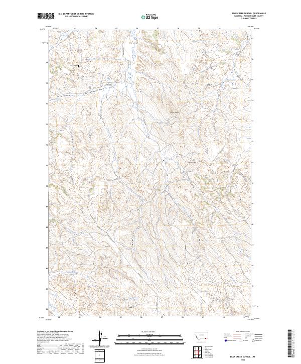
2024 Map of Bear Creek School
USGS Topo · Published 2024About this map
Duffield Cem sits near the northern boundary of this Powder River County landscape, a small site of local historical importance in a region defined by high plains topography and drainage networks. The terrain is marked by prominent elevations including Chico Buttes, Nipple Butte, and Red Butte, which rise above a complex system of draws and seasonal watercourses. Large-scale ranching and land management are evident through the grid of section lines and the network of local roads such as Quietus Rd and Bear Creek Rd. Several named drainages, including Mac Alister Draw and Jojo Draw, feed into primary creeks like Bear Creek and Cedar Creek. This contemporary survey also documents specific natural springs, such as 08S45E24CADD01 Spring, which have long served as vital water sources in the semi-arid environment of southeastern Montana.
Find a feature on this map
29 named features on this map. Tap any name to fly to it.
Don’t see what you’re looking for? This feature index may not catch every label — zoom into the map to look around manually.
Map Details
Editions of this 2024 Bear Creek School Map
This is the sole edition of this map. No revisions or reprints were ever made.
Other maps of this area

1954 · Hardin
USGS Topo · 1:250,000

1955 · Sheridan
USGS Topo · 1:250,000

1957 · Hardin
USGS Topo · 1:250,000

1958 · Hardin
USGS Topo · 1:250,000

1958 · Sheridan
USGS Topo · 1:250,000

1962 · Sheridan
USGS Topo · 1:250,000

1971 · Cabin Creek NW
USGS Topo · 1:24,000
1971 · Cabin Creek NE
USGS Topo · 1:24,000
1971 · Box Elder Draw
USGS Topo · 1:24,000
1972 · Reanus Cone
USGS Topo · 1:24,000