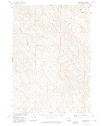
1972 Map of Bear Draw
USGS Topo · Published 1975About this map
Dixon Ranch serves as a primary point of human activity in this landscape defined by an intricate network of seasonal drainages and cattle country infrastructure. Located in Johnson County, the terrain is shaped by numerous ephemeral waterways including Bear Draw, McCray Draw, and Stewart Draw, which feed into the larger system of Flying E Creek. This 1972 field-checked survey reveals a region utilized for ranching and water management, evidenced by the presence of Springs, isolated Wells, and a Water Tank positioned near the northern boundary. The topography transitions toward Somerville Flats West, showing a pattern of land use typical of the Missouri River Basin development era, where topographic features like Coal Gulch and Fleetwood Draw dictate the placement of ranch boundaries and primitive roads.
Find a feature on this map
14 named features on this map. Tap any name to fly to it.
Don’t see what you’re looking for? This feature index may not catch every label — zoom into the map to look around manually.
Map Details
Editions of this 1972 Bear Draw Map
This is the sole edition of this map. No revisions or reprints were ever made.
Other maps of this area

1955 · Sheridan
USGS Topo · 1:250,000

1958 · Sheridan
USGS Topo · 1:250,000

1962 · Sheridan
USGS Topo · 1:250,000

1972 · Mitchell Draw
USGS Topo · 1:24,000
1972 · Crazy Woman Ranch
USGS Topo · 1:24,000
1972 · Ploessers Draw
USGS Topo · 1:24,000
1972 · Pine Gulch
USGS Topo · 1:24,000
1972 · Somerville Flats West
USGS Topo · 1:24,000
1972 · Floate Draw
USGS Topo · 1:24,000
1972 · Juniper Draw
USGS Topo · 1:24,000