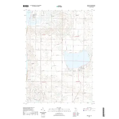
2019 Map of Bear Lake
USGS Topo · Published 2019About this map
The coastal village of Arcadia and the resort community of Bear Lake define this portion of Manistee County near the Lake Michigan shoreline. In the northwest, Arcadia Lake is separated from the lake by a narrow strip of land near Lookout Point, while the settlement of Pierport sits further south along the coast. The interior landscape is marked by numerous small water bodies and creeks, including Cornell Lake, Gordon Lake, and the winding path of Bowens Creek.
Find a feature on this map
109 named features on this map. Tap any name to fly to it.
Don’t see what you’re looking for? This feature index may not catch every label — zoom into the map to look around manually.
Map Details
Editions of this 2019 Bear Lake Map
This is the sole edition of this map. No revisions or reprints were ever made.
Other maps of this area

1954 · Manitowoc
USGS Topo · 1:250,000

1956 · Onekama
USGS Topo · 1:62,500

1956 · Bar Lake
USGS Topo · 1:62,500

1956 · Frankfort
USGS Topo · 1:62,500

1958 · Manitowoc
USGS Topo · 1:250,000

1976 · Frankfort SE
USGS Topo · 1:24,000

1976 · Onekama SE
USGS Topo · 1:24,000

1976 · Frankfort SW
USGS Topo · 1:24,000

1976 · Onekama NW
USGS Topo · 1:24,000

1976 · Onekama SW
USGS Topo · 1:24,000