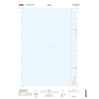
2019 Map of Bear Lake OE W
USGS Topo · Published 2019About this map
Lake Michigan dominates this coastal survey, where the deep waters of the Great Lakes meet the western edge of Manistee County. The topography is concentrated along the narrow eastern margin of the sheet, where several residential roads like Lakeside Ave and Portage Point Dr navigate the rising bluffs and dunes typical of this shoreline. This 2019 edition illustrates the modern road network at the edge of the lake, including Ivanhoe Dr and Dune Dr, providing a precise record of the developed shoreline within t23n r16w and t24n r16w. While largely a hydrographic study of the near-shore lakebed, the map documents the critical interface between the water and the populated coastal strips south of the Manistee National Forest area.
Find a feature on this map
7 named features on this map. Tap any name to fly to it.
Don’t see what you’re looking for? This feature index may not catch every label — zoom into the map to look around manually.
Map Details
Editions of this 2019 Bear Lake OE W Map
This is the sole edition of this map. No revisions or reprints were ever made.
Other maps of this area

1954 · Manitowoc
USGS Topo · 1:250,000

1956 · Onekama
USGS Topo · 1:62,500

1956 · Bar Lake
USGS Topo · 1:62,500

1956 · Frankfort
USGS Topo · 1:62,500

1958 · Manitowoc
USGS Topo · 1:250,000

1976 · Frankfort SW
USGS Topo · 1:24,000

1976 · Onekama NW
USGS Topo · 1:24,000

1976 · Onekama SW
USGS Topo · 1:24,000
1976 · Bar Lake SE
USGS Topo · 1:24,000
1982 · Onekama
USGS Topo · 1:25,000