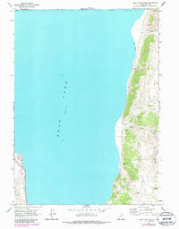
1969 Map of Bear Lake South
USGS Topo · Published 1986About this map
Bear Lake dominates the western portion of this 1969 survey, where the water surface meets the steep eastern slopes of the Bear River Range. The shoreline is characterized by Cisco Beach and a series of deep drainages, most notably North Eden Canyon and South Eden Canyon. These canyons provide the primary topographical relief, cutting through the high country where numerous springs, including Rock Spring and a generic Spring label, feed the local watershed.
Find a feature on this map
15 named features on this map. Tap any name to fly to it.
Don’t see what you’re looking for? This feature index may not catch every label — zoom into the map to look around manually.
Map Details
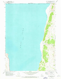
Editions of this 1969 Bear Lake South Map
2 editions found
Other maps of this area

1909 · Montpelier
USGS Topo · 1:125,000

1911 · Montpelier
USGS Topo · 1:125,000

1912 · Randolph
USGS Topo · 1:125,000

1954 · Ogden
USGS Topo · 1:250,000

1955 · Preston
USGS Topo · 1:250,000

1958 · Ogden
USGS Topo · 1:250,000

1958 · Preston
USGS Topo · 1:250,000

1960 · Ogden
USGS Topo · 1:250,000

1962 · Preston
USGS Topo · 1:250,000

1969 · Sheeppen Creek
USGS Topo · 1:24,000