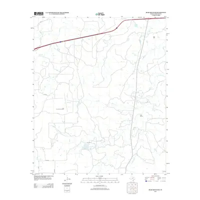
2012 Map of Bear Mountain
USGS Topo · Published 2012About this map
Bear Mtn rises above the drainage network of Eastland County, where the landscape is defined by the headwaters and tributaries of the Palo Pinto Creek system. This 2012 survey reveals a rural landscape dominated by ranching and local aviation, evidenced by the Cook Canyon Ranch Airport and a complex web of county roads such as Cord-485 and Cord-234. Genealogical interests are anchored by the Cook Cem, located near the intersection of the W Fork Palo Pinto Cr and the waters of Dickey Lake. The terrain transitions from the higher elevation of Cook Canyon in the east to the more level plains drained by Bear Cr and Russell Cr to the west. Small water bodies like Fambro Lake and seasonal streams such as Jenny Cr illustrate the vital water management necessary for this region of Central Texas.
Find a feature on this map
19 named features on this map. Tap any name to fly to it.
Don’t see what you’re looking for? This feature index may not catch every label — zoom into the map to look around manually.
Map Details
Editions of this 2012 Bear Mountain Map
This is the sole edition of this map. No revisions or reprints were ever made.
Other maps of this area

1890 · Stephenville
USGS Topo · 1:125,000

1890 · Breckenridge
USGS Topo · 1:125,000

1891 · Palo Pinto
USGS Topo · 1:125,000

1894 · Eastland
USGS Topo · 1:125,000

1918 · Palo Pinto
USGS Topo · 1:125,000

1920 · Stephenville
USGS Topo · 1:125,000

1954 · Abilene
USGS Topo · 1:250,000

1958 · Abilene
USGS Topo · 1:250,000

1959 · Gordon
USGS Topo · 1:62,500

1965 · Huckabay SW
USGS Topo · 1:24,000