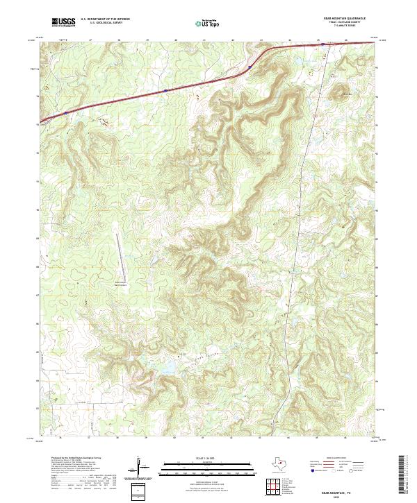
2022 Map of Bear Mountain
USGS Topo · Published 2022About this map
Cook Canyon serves as a central geographic feature in this part of Eastland County, where the terrain is defined by the headwaters of the Palo Pinto Creek system. The confluence of the W Fork Palo Pinto Cr and S Fork Palo Pinto Cr highlights a landscape etched by seasonal drainages like Bear Cr and Brush Cr. Evidence of early settlement and family history is anchored by the Cook Cem, while the modern era is represented by the private Cook Canyon Ranch Airport. To the northeast, the elevation rises toward Bear Mtn, overlooking Fambro Lake and the branching waters of Jenny Cr. This survey illustrates a quiet ranching landscape where small-scale water impoundments like Dickey Lake support local land use amidst the intricate network of local county roads.
Find a feature on this map
17 named features on this map. Tap any name to fly to it.
Don’t see what you’re looking for? This feature index may not catch every label — zoom into the map to look around manually.
Map Details
Editions of this 2022 Bear Mountain Map
This is the sole edition of this map. No revisions or reprints were ever made.
Other maps of this area

1890 · Stephenville
USGS Topo · 1:125,000

1890 · Breckenridge
USGS Topo · 1:125,000

1891 · Palo Pinto
USGS Topo · 1:125,000

1894 · Eastland
USGS Topo · 1:125,000

1918 · Palo Pinto
USGS Topo · 1:125,000

1920 · Stephenville
USGS Topo · 1:125,000

1954 · Abilene
USGS Topo · 1:250,000

1958 · Abilene
USGS Topo · 1:250,000

1959 · Gordon
USGS Topo · 1:62,500

1965 · Huckabay SW
USGS Topo · 1:24,000