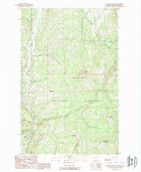
1988 Map of Bear Mountain
USGS Topo · Published 1988About this map
The Colville National Forest dominates this northern Washington terrain, where the Sanpoil River carves a path through the western edge of the quadrangle. High elevations define the landscape, notably at the Quartz Mountain Lookout Tower and the sprawling summits of Thirteenmile Mountain and Bear Mountain. The area reflects a history of natural resource management and extraction, evidenced by a marked Mine near Prospect and several gravel pits scattered along the drainages.
Find a feature on this map
22 named features on this map. Tap any name to fly to it.
Don’t see what you’re looking for? This feature index may not catch every label — zoom into the map to look around manually.
Map Details
Editions of this 1988 Bear Mountain Map
This is the sole edition of this map. No revisions or reprints were ever made.
Other maps of this area

1904 · Republic
USGS Topo · 1:125,000

1948 · Republic
USGS Topo · 1:62,500

1951 · Wauconda
USGS Topo · 1:62,500

1951 · Republic
USGS Topo · 1:62,500

1953 · Seventeenmile Mtn.
USGS Topo · 1:62,500

1953 · Bald Knob
USGS Topo · 1:62,500

1954 · Okanogan
USGS Topo · 1:250,000

1958 · Okanogan
USGS Topo · 1:250,000

1958 · Aeneas
USGS Topo · 1:62,500

1984 · Republic
USGS Topo · 1:100,000