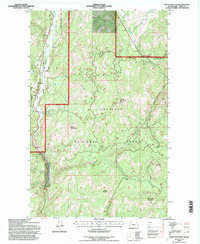
1992 Map of Bear Mountain
USGS Topo · Published 1997About this map
The Sanpoil River valley defines the western edge of this landscape, where the river's winding path is flanked by Indian Allotment boundaries and scattered industrial activity. As part of the Colville National Forest, the terrain is marked by significant elevations including Thirteenmile Mountain and Quartz Mountain, the latter topped by a Lookout. Resource extraction is evident throughout the area, with a Mine and Prospect located near the river, while a Gravel Pit and Sandpit indicate local aggregate production.
Find a feature on this map
34 named features on this map. Tap any name to fly to it.
Don’t see what you’re looking for? This feature index may not catch every label — zoom into the map to look around manually.
Map Details
Editions of this 1992 Bear Mountain Map
This is the sole edition of this map. No revisions or reprints were ever made.
Other maps of this area

1904 · Republic
USGS Topo · 1:125,000

1948 · Republic
USGS Topo · 1:62,500

1951 · Wauconda
USGS Topo · 1:62,500

1951 · Republic
USGS Topo · 1:62,500

1953 · Seventeenmile Mtn.
USGS Topo · 1:62,500

1953 · Bald Knob
USGS Topo · 1:62,500

1954 · Okanogan
USGS Topo · 1:250,000

1958 · Okanogan
USGS Topo · 1:250,000

1958 · Aeneas
USGS Topo · 1:62,500

1984 · Republic
USGS Topo · 1:100,000