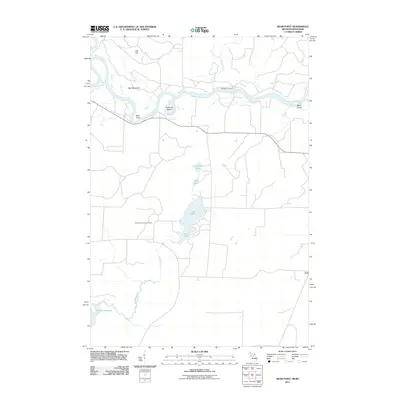
2011 Map of Bear Point
USGS Topo · Published 2011About this map
The Menominee River serves as the central geographic feature of this area, winding through a landscape defined by significant wetlands and elevation changes on the Wisconsin-Michigan border. Sturgeon Landing sits along the river's path, while to the south, a dense cluster of water bodies including Lake Mary, Lake Julia, and Stephenson Lake creates a distinct lakeland character. The terrain is marked by notable rises such as Oak Hill and Bear Mountain, providing a varied topography that contrasts with the low-lying basin of Lake Noquebay in the southwest.
Find a feature on this map
17 named features on this map. Tap any name to fly to it.
Don’t see what you’re looking for? This feature index may not catch every label — zoom into the map to look around manually.
Map Details
Editions of this 2011 Bear Point Map
This is the sole edition of this map. No revisions or reprints were ever made.
Other maps of this area

1939 · Marinette
USGS Topo · 1:48,000

1939 · Porterfield
USGS Topo · 1:48,000

1942 · Porterfield
USGS Topo · 1:48,000

1942 · Wausaukee
USGS Topo · 1:48,000

1947 · Wausaukee
USGS Topo · 1:48,000

1949 · Stephenson
USGS Topo · 1:48,000

1954 · Escanaba
USGS Topo · 1:250,000

1957 · Escanaba
USGS Topo · 1:250,000

1958 · Escanaba
USGS Topo · 1:250,000

1963 · Porterfield
USGS Topo · 1:62,500