
1963 Map of Porterfield
USGS Topo · Published 1964About this map
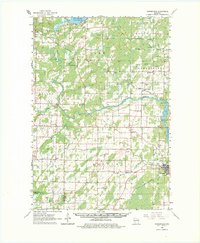
The Peshtigo River carves a central path through this mid-century Wisconsin landscape, its course interrupted by the Potato Rapids Dam and several notable Rapids. Settlement patterns follow the established rail corridors of the Chicago Milwaukee St Paul and Pacific and the Chicago and North Western, which link communities such as Crivitz, Loomis, and Porterfield. The map reveals a robust rural infrastructure of early education and faith, evidenced by numerous named schools like the Fairmont Sch and Woulf Sch, alongside the Porterfield Ch Cem and Harmony Cem. In the northeast, the waters of Lake Noquebay define the shoreline near Stephenson, while the southern reaches near the Little River show the transition toward Oconto County. Extensive Gravel Pits pepper the terrain, signaling the active extraction industries supporting the local economy.
Find a feature on this map
49 named features on this map. Tap any name to fly to it.
Don’t see what you’re looking for? This feature index may not catch every label — zoom into the map to look around manually.
Map Details
Editions of this 1963 Porterfield Map
2 editions found
Other maps of this area

1939 · Marinette
USGS Topo · 1:48,000

1939 · Porterfield
USGS Topo · 1:48,000

1940 · Athelstane
USGS Topo · 1:48,000

1941 · Coleman
USGS Topo · 1:48,000

1942 · Athelstane
USGS Topo · 1:48,000

1942 · Coleman
USGS Topo · 1:48,000

1942 · Porterfield
USGS Topo · 1:48,000

1942 · Wausaukee
USGS Topo · 1:48,000

1947 · Wausaukee
USGS Topo · 1:48,000

1949 · Stephenson
USGS Topo · 1:48,000