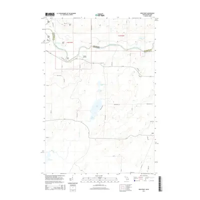
2014 Map of Bear Point
USGS Topo · Published 2014About this map
The Menominee River serves as the winding natural boundary between Wisconsin and Michigan on this modern survey, defining the northern edge of the landscape. To the south, a dense network of water bodies characterizes the terrain, including the northern reach of Lake Noquebay and the smaller Lake Mary and Lake Julia. The presence of Upper Inlet and Stephenson Lake highlights the marshy, low-lying drainage patterns that dictate local road placement. While much of the land is defined by water and wetlands, topographical features like Bear Mtn and Oak Hill rise above the river valley. The small settlement of Goll and landmarks like The Oxbow and Bear Point mark established points of human activity in an area largely dominated by woodland and lakefront properties.
Find a feature on this map
54 named features on this map. Tap any name to fly to it.
Don’t see what you’re looking for? This feature index may not catch every label — zoom into the map to look around manually.
Map Details
Editions of this 2014 Bear Point Map
This is the sole edition of this map. No revisions or reprints were ever made.
Other maps of this area

1939 · Marinette
USGS Topo · 1:48,000

1939 · Porterfield
USGS Topo · 1:48,000

1942 · Porterfield
USGS Topo · 1:48,000

1942 · Wausaukee
USGS Topo · 1:48,000

1947 · Wausaukee
USGS Topo · 1:48,000

1949 · Stephenson
USGS Topo · 1:48,000

1954 · Escanaba
USGS Topo · 1:250,000

1957 · Escanaba
USGS Topo · 1:250,000

1958 · Escanaba
USGS Topo · 1:250,000

1963 · Porterfield
USGS Topo · 1:62,500