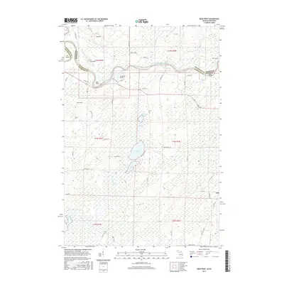
2017 Map of Bear Point
USGS Topo · Published 2017About this map
The Menominee River carves a winding path along the border of Wisconsin and Michigan, defining the northern landscape of this Marinette County region. Prominent riverine features like The Oxbow, Bear Point, and Baker Island highlight the complex hydrology of the valley, while the inland terrain is dotted with significant glacial lakes including Lake Mary, Lake Julia, and Stephenson Lake. This area, characterized by a mix of wetlands and wooded uplands, is bisected by a network of rural roads that connect small clearings and local landmarks such as Oak Hill and Bear Mtn.
Find a feature on this map
62 named features on this map. Tap any name to fly to it.
Don’t see what you’re looking for? This feature index may not catch every label — zoom into the map to look around manually.
Map Details
Editions of this 2017 Bear Point Map
This is the sole edition of this map. No revisions or reprints were ever made.
Other maps of this area

1939 · Marinette
USGS Topo · 1:48,000

1939 · Porterfield
USGS Topo · 1:48,000

1942 · Porterfield
USGS Topo · 1:48,000

1942 · Wausaukee
USGS Topo · 1:48,000

1947 · Wausaukee
USGS Topo · 1:48,000

1949 · Stephenson
USGS Topo · 1:48,000

1954 · Escanaba
USGS Topo · 1:250,000

1957 · Escanaba
USGS Topo · 1:250,000

1958 · Escanaba
USGS Topo · 1:250,000

1963 · Porterfield
USGS Topo · 1:62,500