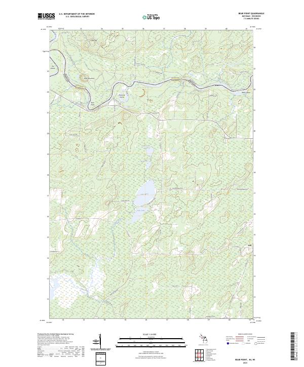
2023 Map of Bear Point
USGS Topo · Published 2023About this map
The Menominee River serves as the winding border between Michigan and Wisconsin, shaping the geography of this borderland. Near a sharp bend in the river, the settlement of Poche de Noche sits across from Bear Point and the prominent Bear Mountain. The landscape is defined by its water systems, from the dramatic curve of The Oxbow in the northwest to a dense cluster of lakes further south including Lake Mary, Lake Julia, and Stephenson Lake. This area reflects a Northwoods character where small communities like Goll are connected by a network of forest roads and county highways. The presence of Baker Island and numerous wetlands along the river corridor underscores the fluvial nature of the boundary, while named hills like Oak Hill provide topographic relief against the surrounding low-lying lake basins.
Find a feature on this map
60 named features on this map. Tap any name to fly to it.
Don’t see what you’re looking for? This feature index may not catch every label — zoom into the map to look around manually.
Map Details
Editions of this 2023 Bear Point Map
This is the sole edition of this map. No revisions or reprints were ever made.
Other maps of this area

1939 · Marinette
USGS Topo · 1:48,000

1939 · Porterfield
USGS Topo · 1:48,000

1942 · Porterfield
USGS Topo · 1:48,000

1942 · Wausaukee
USGS Topo · 1:48,000

1947 · Wausaukee
USGS Topo · 1:48,000

1949 · Stephenson
USGS Topo · 1:48,000

1954 · Escanaba
USGS Topo · 1:250,000

1957 · Escanaba
USGS Topo · 1:250,000

1958 · Escanaba
USGS Topo · 1:250,000

1963 · Porterfield
USGS Topo · 1:62,500