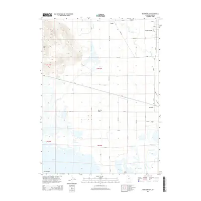
2014 Map of Bear River City
USGS Topo · Published 2014About this map
Bear River City and Corinne anchor this 2014 geographic study of the Bear River Valley, where the Malad River joins the larger Bear River current before it empties into the northern reaches of the Great Salt Lake. The landscape is a complex network of hydrological features and irrigation corridors, including Appledale Slough, Sulphur Creek, and the wetlands of North Bay and East Bay. To the west, the terrain rises sharply toward Little Mountain, a prominent landmark overlooking the mineral-rich waters of Stinking Springs. The southern edge of the map transitions into the salt flats and marshes near Fish Fossil Rocks, while the Corinne Cemetery serves as a significant genealogical point of interest on the outskirts of its namesake settlement. This modern survey illustrates the enduring relationship between the region's agricultural road grid, such as Iowa String Road, and the natural flow of the river system.
Find a feature on this map
86 named features on this map. Tap any name to fly to it.
Don’t see what you’re looking for? This feature index may not catch every label — zoom into the map to look around manually.
Map Details
Editions of this 2014 Bear River City Map
This is the sole edition of this map. No revisions or reprints were ever made.
Other maps of this area

1954 · Whistler Canal
USGS Topo · 1:24,000

1954 · Public Shooting Grounds
USGS Topo · 1:24,000

1954 · Brigham City
USGS Topo · 1:250,000

1955 · Mouth of Bear River
USGS Topo · 1:24,000

1955 · Bear River City
USGS Topo · 1:24,000

1955 · Willard
USGS Topo · 1:24,000

1955 · Brigham City
USGS Topo · 1:24,000

1958 · Brigham City
USGS Topo · 1:250,000

1961 · Thatcher Mountain
USGS Topo · 1:62,500

1961 · Honeyville
USGS Topo · 1:24,000