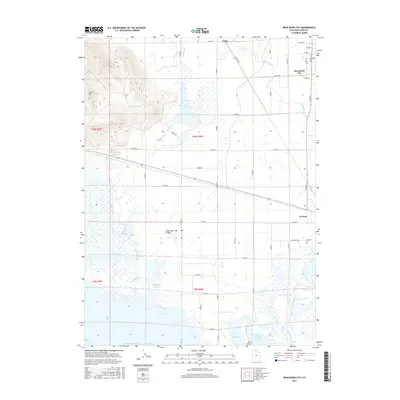
2017 Map of Bear River City
USGS Topo · Published 2017About this map
Bear River City and Corinne anchor this northern Utah landscape where the Malad River joins the larger Bear River drainage. The terrain is defined by the contrast between the high ground of Little Mtn to the northwest and the extensive wetland systems of the south, including Appledale Slough and several distinct bays like North Bay and Stanley McGraw Bay. This 2017 survey details a sophisticated network of irrigation and water management, necessary for the agricultural life in the Bear River Valley. Notable landmarks for local researchers include the Corinne Cem and the sulfurous waters of Stinking Springs near the base of the mountains. The map also captures the grid of county roads, such as Wakegan Rd and Cemetery Rd, which connect the small settlements of Evans to the broader valley floor.
Find a feature on this map
55 named features on this map. Tap any name to fly to it.
Don’t see what you’re looking for? This feature index may not catch every label — zoom into the map to look around manually.
Map Details
Editions of this 2017 Bear River City Map
This is the sole edition of this map. No revisions or reprints were ever made.
Other maps of this area

1954 · Whistler Canal
USGS Topo · 1:24,000

1954 · Public Shooting Grounds
USGS Topo · 1:24,000

1954 · Brigham City
USGS Topo · 1:250,000

1955 · Mouth of Bear River
USGS Topo · 1:24,000

1955 · Bear River City
USGS Topo · 1:24,000

1955 · Willard
USGS Topo · 1:24,000

1955 · Brigham City
USGS Topo · 1:24,000

1958 · Brigham City
USGS Topo · 1:250,000

1961 · Thatcher Mountain
USGS Topo · 1:62,500

1961 · Honeyville
USGS Topo · 1:24,000