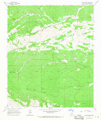
1965 Map of Bear Spring
USGS Topo · Published 1968About this map
The Lincoln National Forest dominates this mid-1960s terrain, revealing a network of drainage systems and isolated landmarks. The presence of the Jeffers Cem and several named water sources like Jeffers Spring and Gage Spring suggests early ranching or homesteading activity in these highlands. The landscape is defined by its deep incisions, with Bluewater Creek and Pinon Creek carving through the plateau alongside numerous canyons named for local figures or characteristics, such as Jim Lewis Canyon and Ben Williams Canyon. Higher elevations are monitored from the Carrisa Lookout Tower, while landmarks like Lick Ridge and Salt Rock Canyon provide further orientation. This survey serves as a record of the remote interior of Otero County before more modern development, highlighting the critical importance of reliable water sources like McEwan Spring and Bear Spring in the high desert environment.
Find a feature on this map
26 named features on this map. Tap any name to fly to it.
Don’t see what you’re looking for? This feature index may not catch every label — zoom into the map to look around manually.
Map Details
Editions of this 1965 Bear Spring Map
2 editions found
Other maps of this area

1952 · Cloudcroft
USGS Topo · 1:62,500

1954 · Carlsbad
USGS Topo · 1:250,000

1958 · Carlsbad
USGS Topo · 1:250,000

1963 · Woodson Canyon
USGS Topo · 1:24,000

1965 · Bear Spring
USGS Topo · 1:24,000

1965 · Surveyors Canyon
USGS Topo · 1:24,000

1965 · Avis
USGS Topo · 1:24,000

1965 · Rogers Ruins
USGS Topo · 1:24,000

1965 · El Paso Canyon
USGS Topo · 1:24,000

1965 · Pinon
USGS Topo · 1:24,000