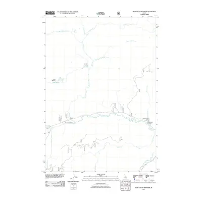
2011 Map of Bear Valley Mountain
USGS Topo · Published 2011About this map
Bear Valley Mountain dominates this Idaho landscape, where a complex network of high-elevation waterways converges. The drainage system is particularly dense, with Elk Creek receiving numerous tributaries including the North Fork, East Fork, and Little East Fork. Human presence is concentrated along the river corridors, marked by the administrative Bear Valley Patrol Cabin and leisure sites like Elk Creek Campground and Tennessee Creek Campground. Transportation follows the water, with Bear Valley Rd tracing the valley floor and crossing the creek at Twin Bridges. The geography is further defined by substantial openings in the forest canopy such as Corduroy Meadows, Crane Meadow, and Bearskin Meadows, which historically served as vital landmarks for navigation and grazing in this part of Valley County.
Find a feature on this map
22 named features on this map. Tap any name to fly to it.
Don’t see what you’re looking for? This feature index may not catch every label — zoom into the map to look around manually.
Map Details
Editions of this 2011 Bear Valley Mountain Map
This is the sole edition of this map. No revisions or reprints were ever made.
Other maps of this area

1891 · Bear Valley
USGS Topo · 1:125,000

1893 · Bear Valley
USGS Topo · 1:125,000

1909 · Garden Valley
USGS Topo · 1:125,000

1953 · Deadwood Reservoir
USGS Topo · 1:62,500

1954 · Warm Lake
USGS Topo · 1:62,500

1957 · Challis
USGS Topo · 1:250,000

1960 · Challis
USGS Topo · 1:250,000

1961 · Chinook Mtn
USGS Topo · 1:62,500

1963 · Challis
USGS Topo · 1:250,000

1972 · Bull Trout Point
USGS Topo · 1:24,000