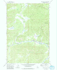
1972 Map of Bear Valley Mtn
USGS Topo · Published 1984About this map
Boise National Forest provides the backdrop for this 1970s survey of the high backcountry in Valley County. The landscape is defined by the drainage basins of Elk Creek, Bearskin Creek, and Bear Valley Creek, where water systems converge near established mountain outposts. The Elk Creek Ranger Station stands as a central landmark for forest management and navigation, situated near recreation sites like Elk Creek Campground and Twin Bridges.
Find a feature on this map
27 named features on this map. Tap any name to fly to it.
Don’t see what you’re looking for? This feature index may not catch every label — zoom into the map to look around manually.
Map Details
Editions of this 1972 Bear Valley Mtn Map
This is the sole edition of this map. No revisions or reprints were ever made.
Other maps of this area

1891 · Bear Valley
USGS Topo · 1:125,000

1893 · Bear Valley
USGS Topo · 1:125,000

1909 · Garden Valley
USGS Topo · 1:125,000

1953 · Deadwood Reservoir
USGS Topo · 1:62,500

1954 · Warm Lake
USGS Topo · 1:62,500

1957 · Challis
USGS Topo · 1:250,000

1960 · Challis
USGS Topo · 1:250,000

1961 · Chinook Mtn
USGS Topo · 1:62,500

1963 · Challis
USGS Topo · 1:250,000

1972 · Bull Trout Point
USGS Topo · 1:24,000