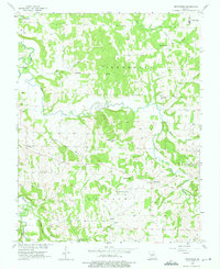
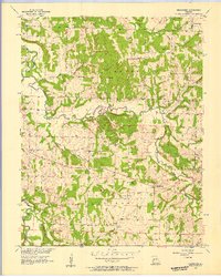
1956 Map of Bearcreek
USGS Topo · Published 1975About this map
The Little Sac River and its numerous tributaries, including Bear Creek, Crabtree Branch, and Alder Branch, define the topography of this Cedar County region during the mid-1950s. The landscape is characterized by its rural social structure, anchored by a series of country churches and associated cemeteries such as Lindley Prairie Ch. and Forest Home Ch. These sites, along with the Friendship Community Hall, served as the primary gathering points for the dispersed residents of Jefferson, Madison, and Washington townships. The settlement of Bearcreek sits near the center of this network, while prominent local elevations like The Mound and Sand Hill provide landmark visibility across the creek bottoms. The 1956 field check captured a moment when traditional land divisions and small-scale community hubs remained the dominant features of the Missouri countryside before later decades of agricultural consolidation.
Find a feature on this map
34 named features on this map. Tap any name to fly to it.
Don’t see what you’re looking for? This feature index may not catch every label — zoom into the map to look around manually.
Map Details
Editions of this 1956 Bearcreek Map
3 editions found
Other maps of this area

1886 · Stockton
USGS Topo · 1:125,000

1939 · Caplinger Mills
USGS Topo · 1:24,000

1939 · Arnica
USGS Topo · 1:24,000

1941 · Caplinger Mills
USGS Topo · 1:24,000

1941 · Arnica
USGS Topo · 1:24,000

1944 · Humansville
USGS Topo · 1:24,000

1954 · Springfield
USGS Topo · 1:250,000
1956 · Fair Play
USGS Topo · 1:24,000
1956 · Stockton
USGS Topo · 1:24,000
1956 · Bearcreek
USGS Topo · 1:24,000