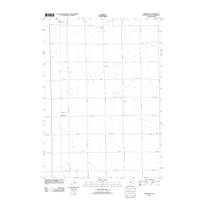
2012 Map of Beardsley
USGS Topo · Published 2012About this map
The settlement of Beardsley and a dense network of rural family and community burial grounds define this portion of Hutchinson County. Genealogists will find a wealth of specific locations including Dakota City Cem, Zion Cem, and Rosenfeld Cem scattered across the agricultural landscape. The terrain is structured by a precise section-line road grid, including 411th Ave and 282nd St, which navigate the various drainage branches of the plains. Waterways such as N Br Dry Cr and Dawson Cr meander through the fields, while the Parkston Municipal Airport occupies the northwest corner of the survey. This map effectively documents the transition of the South Dakota prairie into a structured pastoral region marked by its legacy cemeteries like Bethel Cem and Pietz Cem.
Find a feature on this map
28 named features on this map. Tap any name to fly to it.
Don’t see what you’re looking for? This feature index may not catch every label — zoom into the map to look around manually.
Map Details
Editions of this 2012 Beardsley Map
This is the sole edition of this map. No revisions or reprints were ever made.
Other maps of this area

1898 · Olivet
USGS Topo · 1:125,000

1955 · Sioux Falls
USGS Topo · 1:250,000

1955 · Mitchell
USGS Topo · 1:250,000

1957 · Milltown
USGS Topo · 1:24,000

1958 · Sioux Falls
USGS Topo · 1:250,000

1959 · Mitchell
USGS Topo · 1:250,000

1977 · Oak Hollow
USGS Topo · 1:24,000

1978 · Oak Hollow
USGS Topo · 1:24,000
1978 · Kaylor
USGS Topo · 1:24,000
1978 · Tripp
USGS Topo · 1:24,000