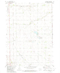
1980 Map of Beardsley
USGS Topo · Published 1980About this map
Beardsley and its surrounding townships in Hutchinson County appear here as a landscape defined by geometric section lines and scattered agricultural landmarks in the mid-1970s. The survey captures a high density of small burial grounds, including Dakota City Cem, Zion Cem, and Rosenfeld Cem, reflecting the early pioneer settlement patterns of the region. The path of the Chicago Milwaukee St Paul and Pacific railroad cuts through the western sections, providing the primary connection for the small prairie community.
Find a feature on this map
23 named features on this map. Tap any name to fly to it.
Don’t see what you’re looking for? This feature index may not catch every label — zoom into the map to look around manually.
Map Details
Editions of this 1980 Beardsley Map
This is the sole edition of this map. No revisions or reprints were ever made.
Other maps of this area

1898 · Olivet
USGS Topo · 1:125,000

1955 · Sioux Falls
USGS Topo · 1:250,000

1955 · Mitchell
USGS Topo · 1:250,000

1957 · Milltown
USGS Topo · 1:24,000

1958 · Sioux Falls
USGS Topo · 1:250,000

1959 · Mitchell
USGS Topo · 1:250,000

1977 · Oak Hollow
USGS Topo · 1:24,000

1978 · Oak Hollow
USGS Topo · 1:24,000
1978 · Kaylor
USGS Topo · 1:24,000
1978 · Tripp
USGS Topo · 1:24,000
Featured Places
- Milltown Township, SD
- Oak Hollow Township, SD
- German Township, SD
- Susquehanna Township, SD
- Kulm Township, SD