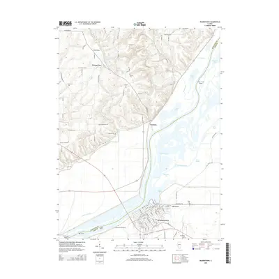
2015 Map of Beardstown
USGS Topo · Published 2015About this map
The Illinois River and Sangamon River converge in this riverine landscape, defining the borders between Schuyler Co and Cass Co. The city of Beardstown dominates the southeastern quadrant, its grid extending toward the water and the Beardstown City Cem. North of the river, the smaller settlements of Frederick and Pleasant View sit along the bluffs, separated by the agricultural drainage of Scab Hollow and Coal Cr.
Find a feature on this map
106 named features on this map. Tap any name to fly to it.
Don’t see what you’re looking for? This feature index may not catch every label — zoom into the map to look around manually.
Map Details
Editions of this 2015 Beardstown Map
This is the sole edition of this map. No revisions or reprints were ever made.
Other maps of this area

1923 · Rushville
USGS Topo · 1:62,500

1926 · Beardstown
USGS Topo · 1:62,500

1926 · Rushville
USGS Topo · 1:62,500

1928 · Meredosia
USGS Topo · 1:62,500

1929 · Arenzville
USGS Topo · 1:62,500

1931 · Meredosia
USGS Topo · 1:62,500

1932 · Arenzville
USGS Topo · 1:62,500

1944 · Beardstown
USGS Topo · 1:62,500

1948 · Quincy
USGS Topo · 1:250,000

1956 · Quincy
USGS Topo · 1:250,000