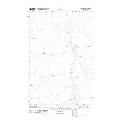
2011 Map of Bearpaw Lake
USGS Topo · Published 2011About this map
Shambo Springs and the drainage of Beaver Creek define this section of Hill County, Montana. The landscape is characterized by a network of coulees and high points, including the prominent Shambo Mountain and Manikanis Ridge. In the northern portion of the quadrangle, Bearpaw Lake is held by the Bearpaw Lake Dam, serving as a central water feature for the surrounding terrain.
Find a feature on this map
32 named features on this map. Tap any name to fly to it.
Don’t see what you’re looking for? This feature index may not catch every label — zoom into the map to look around manually.
Map Details
Editions of this 2011 Bearpaw Lake Map
This is the sole edition of this map. No revisions or reprints were ever made.
Other maps of this area

1953 · Havre
USGS Topo · 1:250,000

1957 · Havre
USGS Topo · 1:250,000

1958 · Havre
USGS Topo · 1:250,000

1959 · Warrick
USGS Topo · 1:62,500

1959 · Laredo
USGS Topo · 1:62,500

1959 · Centennial Mountain
USGS Topo · 1:62,500

1959 · Shambo
USGS Topo · 1:62,500
1984 · Bearpaw Lake
USGS Topo · 1:24,000
1984 · Shambo NE
USGS Topo · 1:24,000
1984 · Laredo NE
USGS Topo · 1:24,000