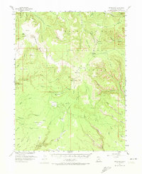
1954 Map of Bears Ears
USGS Topo · Published 1974About this map
The historical Mormon Trail crosses this 1954 topographic record, which captures the remote San Juan County landscape during a period of active uranium prospecting and land management. The Atomic Energy Commission cooperated in the survey of this region, where the twin summits of Bears Ears stand as a central landmark between the deep cuts of Woodenshoe Canyon and Arch Canyon. This era of the Manti-La Sal National Forest is evidenced by the Kigalia Ranger Sta and an Airstrip perched on the high plateau of Elk Ridge.
Find a feature on this map
82 named features on this map. Tap any name to fly to it.
Don’t see what you’re looking for? This feature index may not catch every label — zoom into the map to look around manually.
Map Details
Editions of this 1954 Bears Ears Map
4 editions found

Other maps of this area

1886 · Henry Mountains
USGS Topo · 1:250,000

1886 · Abajo
USGS Topo · 1:250,000

1892 · Abajo
USGS Topo · 1:250,000

1892 · Henry Mountains
USGS Topo · 1:250,000

1893 · Abajo
USGS Topo · 1:250,000

1935 · Elk Ridge
USGS Topo · 1:96,000

1940 · Elk Ridge
USGS Topo · 1:125,000

1952 · Mouth of Dark Canyon
USGS Topo · 1:62,500

1952 · Natural Bridges
USGS Topo · 1:62,500

1954 · Elk Ridge 4 NW
USGS Topo · 1:24,000