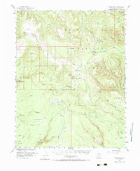
1954 Map of Bears Ears
USGS Topo · Published 1984About this map
Bears Ears stands as a prominent landmark within the Manti-La Sal National Forest, overlooking a complex system of deep canyons and high mesas. This mid-century survey, conducted in cooperation with the Atomic Energy Commission, highlights the region's isolated outposts and ancient history. Traces of early migration and habitation are visible through the Mormon Trail crossing Harmony Flat and the presence of several Cliff Dwellings tucked into the canyon walls. The map details a landscape managed for both utility and preservation, featuring the Kigalia Ranger Sta and an Airstrip alongside the eastern boundary of Natural Bridges Natl Mon. High-altitude grazing areas like Babylon Pasture and named springs such as Twin Springs suggest the seasonal movement of livestock through the high desert, while a Prospect near Upper Lost Parks indicates the era's interest in mineral exploration.
Find a feature on this map
69 named features on this map. Tap any name to fly to it.
Don’t see what you’re looking for? This feature index may not catch every label — zoom into the map to look around manually.
Map Details
Editions of this 1954 Bears Ears Map
4 editions found

Other maps of this area

1886 · Henry Mountains
USGS Topo · 1:250,000

1886 · Abajo
USGS Topo · 1:250,000

1892 · Abajo
USGS Topo · 1:250,000

1892 · Henry Mountains
USGS Topo · 1:250,000

1893 · Abajo
USGS Topo · 1:250,000

1935 · Elk Ridge
USGS Topo · 1:96,000

1940 · Elk Ridge
USGS Topo · 1:125,000

1952 · Mouth of Dark Canyon
USGS Topo · 1:62,500

1952 · Natural Bridges
USGS Topo · 1:62,500

1954 · Elk Ridge 4 NW
USGS Topo · 1:24,000