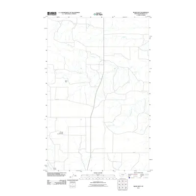
2011 Map of Bears Nest
USGS Topo · Published 2011About this map
Bears Nest is situated within the Wolf Point District of Roosevelt County, illustrating a landscape defined by the drainage patterns of the northern Great Plains. Water is the primary architect of this terrain, with Sage Creek and Assiniboine Creek carving subtle paths across the prairie. The presence of the Fort Peck Reservation Number 21 Dam reflects the 20th-century history of land management and resource development within tribal lands, creating a distinct water feature in an otherwise arid expanse.
Find a feature on this map
8 named features on this map. Tap any name to fly to it.
Don’t see what you’re looking for? This feature index may not catch every label — zoom into the map to look around manually.
Map Details
Editions of this 2011 Bears Nest Map
This is the sole edition of this map. No revisions or reprints were ever made.
Other maps of this area

1910 · Cuskers
USGS Topo · 1:62,500

1915 · Tule Valley
USGS Topo · 1:62,500

1915 · Cuskers
USGS Topo · 1:62,500

1954 · Wolf Point
USGS Topo · 1:250,000

1958 · Wolf Point
USGS Topo · 1:250,000

1973 · Bredette
USGS Topo · 1:24,000

1973 · Nielsen Coulee
USGS Topo · 1:24,000

1973 · Peerless 4 SE
USGS Topo · 1:24,000
1983 · Tule Valley East
USGS Topo · 1:24,000
1983 · Long Creek West
USGS Topo · 1:24,000