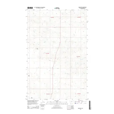
2014 Map of Bears Nest
USGS Topo · Published 2014About this map
Bears Nest rises as a prominent landmark in this segment of Roosevelt County, defining a landscape shaped by intermittent watercourses and the sprawling reach of the Great Plains. The map highlights a network of drainage systems including Sage Creek in the north and Assiniboine Creek further south, both typical of the prairie's undulating terrain. Isolated water sources like Snell Spring suggest the importance of specific points for livestock or local travel in this open country. The modern infrastructure is anchored by MT-13, which bisects the quadrangle from north to south, providing the primary corridor through this sparsely populated region. This survey captures the rural character of the Wolf Point District, where county roads such as CR-2037 and CR-2040 branch off to connect remote sections of the township and range grid.
Find a feature on this map
17 named features on this map. Tap any name to fly to it.
Don’t see what you’re looking for? This feature index may not catch every label — zoom into the map to look around manually.
Map Details
Editions of this 2014 Bears Nest Map
This is the sole edition of this map. No revisions or reprints were ever made.
Other maps of this area

1910 · Cuskers
USGS Topo · 1:62,500

1915 · Tule Valley
USGS Topo · 1:62,500

1915 · Cuskers
USGS Topo · 1:62,500

1954 · Wolf Point
USGS Topo · 1:250,000

1958 · Wolf Point
USGS Topo · 1:250,000

1973 · Bredette
USGS Topo · 1:24,000

1973 · Nielsen Coulee
USGS Topo · 1:24,000

1973 · Peerless 4 SE
USGS Topo · 1:24,000
1983 · Tule Valley East
USGS Topo · 1:24,000
1983 · Long Creek West
USGS Topo · 1:24,000