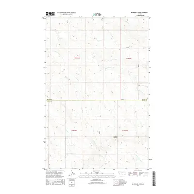
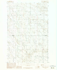
2017 Map of Bearshack Creek
USGS Topo · Published 2017About this map
The Big Sheep Mountains dominate the southern portion of this landscape where the borders of McCone and Prairie Counties meet. This high-relief terrain is defined by a complex drainage system where Bearshack Cr and Pasture Cr carve through the breaks toward the south, while the northern sections are shaped by the various branches of Tusler Cr. The map captures a section of the Montana rangelands where human presence is marked primarily by isolated through-roads like Union Rd and Prairie Rd. A notable topographic landmark, the Lower Summit, sits near the northeastern corner, providing a clear vantage point over the converging valleys of Dry Ash Cr and the N Fork Tusler Cr. The lack of formal settlements highlights the open, rural nature of this region during the late 2010s.
Find a feature on this map
18 named features on this map. Tap any name to fly to it.
Don’t see what you’re looking for? This feature index may not catch every label — zoom into the map to look around manually.
Map Details
Editions of this 2017 Bearshack Creek Map
This is the sole edition of this map. No revisions or reprints were ever made.
Other maps of this area

1954 · Glendive
USGS Topo · 1:250,000

1957 · Glendive
USGS Topo · 1:250,000

1958 · Glendive
USGS Topo · 1:250,000

1982 · Circle
USGS Topo · 1:100,000
1983 · Becker Dam
USGS Topo · 1:24,000
1983 · Big Sheep Mountain
USGS Topo · 1:24,000
1983 · North Coulee
USGS Topo · 1:24,000

1983 · Mount Antelope
USGS Topo · 1:24,000

1983 · Quick Reservoir
USGS Topo · 1:24,000
1983 · Bearshack Creek
USGS Topo · 1:24,000