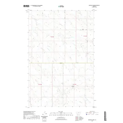
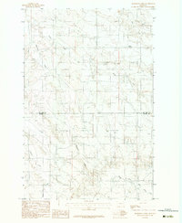
2020 Map of Bearshack Creek
USGS Topo · Published 2020About this map
The Big Sheep Mountains dominate the southern landscape of this Eastern Montana quadrangle, defining the drainage patterns across the McCone Co and Prairie Co line. This high-country terrain is dissected by a network of seasonal watercourses, including the central Bearshack Cr and the various branches of Tusler Cr. The topography reveals a sparsely settled ranching landscape where local travel depends on long-established routes like Union Rd and Prairie Rd. A notable landmark, the Lower Summit, sits in the northeastern portion of the map, overlooking the headwaters of Dry Ash Cr. The transition from the rugged highlands to the more open creek valleys highlights the geographic isolation of this territory, where water sources such as Pasture Cr and the Middle Fork Bad Route Cr were vital for both land surveying and livestock.
Find a feature on this map
18 named features on this map. Tap any name to fly to it.
Don’t see what you’re looking for? This feature index may not catch every label — zoom into the map to look around manually.
Map Details
Editions of this 2020 Bearshack Creek Map
This is the sole edition of this map. No revisions or reprints were ever made.
Other maps of this area

1954 · Glendive
USGS Topo · 1:250,000

1957 · Glendive
USGS Topo · 1:250,000

1958 · Glendive
USGS Topo · 1:250,000

1982 · Circle
USGS Topo · 1:100,000
1983 · Becker Dam
USGS Topo · 1:24,000
1983 · Big Sheep Mountain
USGS Topo · 1:24,000
1983 · North Coulee
USGS Topo · 1:24,000

1983 · Mount Antelope
USGS Topo · 1:24,000

1983 · Quick Reservoir
USGS Topo · 1:24,000
1983 · Bearshack Creek
USGS Topo · 1:24,000