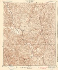
1938 Map of Beartrap Canyon
USGS Topo · Published 1938About this map
The mountain pass corridors of northern Los Angeles County are captured here during the 1930s, showing the early infrastructure that connected the Central Valley to the coast. Route 99 winds through the canyons, serving as a primary artery alongside a major Transmission Line and the Liebre Pumping Sta. Small roadside outposts like the Halfway Inn and landings such as French Flat and Osito provide evidence of early automobile-era travel and local habitation in this demanding landscape.
Find a feature on this map
19 named features on this map. Tap any name to fly to it.
Don’t see what you’re looking for? This feature index may not catch every label — zoom into the map to look around manually.
Map Details
Editions of this 1938 Beartrap Canyon Map
3 editions found

Other maps of this area

1903 · Tejon
USGS Topo · 1:125,000

1931 · Whitaker Peak
USGS Topo · 1:24,000

1931 · Redrock Mtn
USGS Topo · 1:24,000

1932 · Beartrap Canyon
USGS Topo · 1:24,000

1932 · Neenach
USGS Topo · 1:24,000

1933 · Quail
USGS Topo · 1:24,000

1933 · Gorman
USGS Topo · 1:24,000

1935 · Whitaker Peak
USGS Topo · 1:24,000
1936 · Redrock Mtn.
USGS Topo · 1:24,000
1937 · Violin Canyon
USGS Topo · 1:24,000