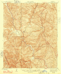
1938 Map of Beartrap Canyon
USGS Topo · Published 1948About this map
Los Padres National Forest contains a rugged intersection of mid-century infrastructure and remote canyons within northern Los Angeles County. The Golden State Highway winds through the western portion of the sheet, supported by a State Hy Maintenance Sta near Canada de los Alamos. This era of the roadway predates modern interstate alignments, showing the original winding path of the Ridge Route as it traverses the high ground near Lookout Reservoir Hill.
Find a feature on this map
20 named features on this map. Tap any name to fly to it.
Don’t see what you’re looking for? This feature index may not catch every label — zoom into the map to look around manually.
Map Details
Editions of this 1938 Beartrap Canyon Map
3 editions found

Other maps of this area

1903 · Tejon
USGS Topo · 1:125,000

1931 · Whitaker Peak
USGS Topo · 1:24,000

1931 · Redrock Mtn
USGS Topo · 1:24,000

1932 · Beartrap Canyon
USGS Topo · 1:24,000

1932 · Neenach
USGS Topo · 1:24,000

1933 · Quail
USGS Topo · 1:24,000

1933 · Gorman
USGS Topo · 1:24,000

1935 · Whitaker Peak
USGS Topo · 1:24,000
1936 · Redrock Mtn.
USGS Topo · 1:24,000
1937 · Violin Canyon
USGS Topo · 1:24,000