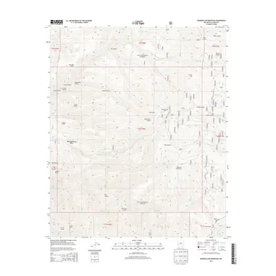
2013 Map of Bearwallow Mountain
USGS Topo · Published 2013About this map
Old Waterman Place stands as a focal point in this high-altitude landscape within the Gila National Forest, where water sources define the geography. The terrain is characterized by a complex network of canyons, including Savage Canyon, Gooseberry Canyon, and Corral Canyon, which drain the slopes of the Mogollon Mountains. High peaks such as Bearwallow Mtn and Cooney Peak overlook a system of livestock infrastructure, evidenced by numerous named tanks like Bill Lewis Tank and Indian Tank. The presence of features like Bill Lewis Cienega and Turkey Cienega suggests the seasonal wetlands and meadows critical for mountain grazing and local wildlife. Extensive forest service routes, including the Bearwallow Lookout Rd, navigate the ridges and connect these isolated water sources and peaks, reflecting the area's primary use for forest management and ranching.
Find a feature on this map
131 named features on this map. Tap any name to fly to it.
Don’t see what you’re looking for? This feature index may not catch every label — zoom into the map to look around manually.
Map Details
Editions of this 2013 Bearwallow Mountain Map
This is the sole edition of this map. No revisions or reprints were ever made.
Other maps of this area

1910 · Mogollon
USGS Topo · 1:125,000

1912 · Mogollon
USGS Topo · 1:125,000

1915 · Reserve
USGS Topo · 1:125,000

1918 · Reserve
USGS Topo · 1:125,000

1954 · Clifton
USGS Topo · 1:250,000

1957 · Clifton
USGS Topo · 1:250,000

1958 · Clifton
USGS Topo · 1:250,000

1962 · Clifton
USGS Topo · 1:250,000

1963 · Bearwallow Mountain
USGS Topo · 1:24,000

1963 · Negrito Mountain
USGS Topo · 1:24,000