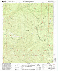
1999 Map of Bearwallow Mountain
USGS Topo · Published 2002About this map
Gila National Forest dominates this landscape in the late twentieth century, centered on the high peaks and steep canyons of the Mogollon Mountains. The terrain is marked by a complex network of drainage basins, including Gooseberry Creek, Bearwallow Creek, and Mineral Creek. Evidence of human activity and habitation is scattered across these remote ridges, noted by the Old Waterman Place and a Trailer Cabin near Cooney Peak. These sites, along with the numerous named tanks like Bull Pasture Tank and Hogwallow Tank, illustrate the essential role of water management for ranching and survival in this arid high-country environment.
Find a feature on this map
56 named features on this map. Tap any name to fly to it.
Don’t see what you’re looking for? This feature index may not catch every label — zoom into the map to look around manually.
Map Details
Editions of this 1999 Bearwallow Mountain Map
This is the sole edition of this map. No revisions or reprints were ever made.
Other maps of this area

1910 · Mogollon
USGS Topo · 1:125,000

1912 · Mogollon
USGS Topo · 1:125,000

1915 · Reserve
USGS Topo · 1:125,000

1918 · Reserve
USGS Topo · 1:125,000

1954 · Clifton
USGS Topo · 1:250,000

1957 · Clifton
USGS Topo · 1:250,000

1958 · Clifton
USGS Topo · 1:250,000

1962 · Clifton
USGS Topo · 1:250,000

1963 · Bearwallow Mountain
USGS Topo · 1:24,000

1963 · Negrito Mountain
USGS Topo · 1:24,000