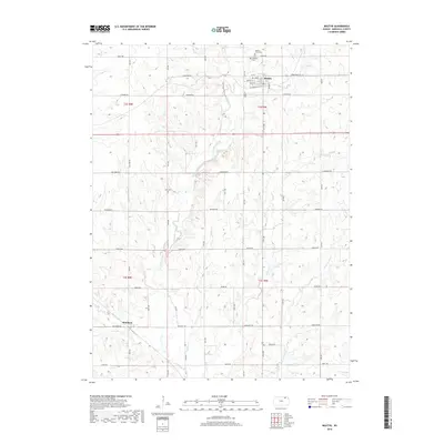
2018 Map of Beattie
USGS Topo · Published 2018About this map
Beattie serves as the primary municipal center in this section of Marshall County, situated along the upper reaches of Wolf Cr. The town's grid is well-defined by streets such as Main St, Walnut St, and Oak St, with Beattie Union Cem and Saint Malachys Cem located on the northern periphery near Indian Rd. This landscape is characterized by a dense network of creek drainages, including Robidoux Creek and its tributaries Skeeter Cr and Snipe Cr, which have carved intricate contours across the rural township lands of t2s r8e and t3s r9e.
Find a feature on this map
31 named features on this map. Tap any name to fly to it.
Don’t see what you’re looking for? This feature index may not catch every label — zoom into the map to look around manually.
Map Details
Editions of this 2018 Beattie Map
This is the sole edition of this map. No revisions or reprints were ever made.
Other maps of this area

1889 · Seneca
USGS Topo · 1:125,000

1889 · Marysville
USGS Topo · 1:125,000

1894 · Seneca
USGS Topo · 1:125,000

1894 · Marysville
USGS Topo · 1:125,000

1955 · Manhattan
USGS Topo · 1:250,000

1956 · Manhattan
USGS Topo · 1:250,000

1957 · Manhattan
USGS Topo · 1:250,000

1966 · Oketo
USGS Topo · 1:24,000

1966 · Axtell
USGS Topo · 1:24,000

1966 · Home
USGS Topo · 1:24,000