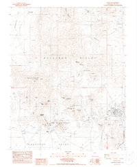
1987 Map of Beatty
USGS Topo · Published 1987About this map
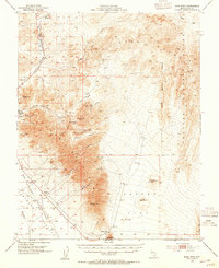
Rhyolite and Beatty anchor this portion of the Bullfrog Hills, a landscape defined by an intensive mining history. The map shows the area in the late 1980s, preserving the locations of numerous historic claims like the Montgomery-Shoshone Mine, Senator Stewart Mine, and the National Bank Mine surrounding Ladd Mountain. While Beatty serves as a hub near the Amargosa River, the former boomtown of Rhyolite is marked with several Ruins, including remnants near Bonanza Mtn.
Find a feature on this map
56 named features on this map. Tap any name to fly to it.
Don’t see what you’re looking for? This feature index may not catch every label — zoom into the map to look around manually.
Map Details
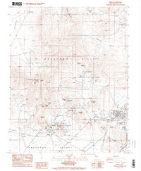
Editions of this 1987 Beatty Map
2 editions found
Other maps of this area

1908 · Kawich
USGS Topo · 1:250,000

1908 · Furnace Creek
USGS Topo · 1:250,000

1910 · Furnace Creek
USGS Topo · 1:250,000
1942 · Tolicha Peak
USGS Topo · 1:125,000
1942 · Bullfrog
USGS Topo · 1:125,000

1948 · Death Valley
USGS Topo · 1:250,000
1954 · Bare Mtn
USGS Topo · 1:62,500
1954 · Bullfrog
USGS Topo · 1:62,500

1954 · Death Valley
USGS Topo · 1:250,000

1954 · Goldfield
USGS Topo · 1:250,000