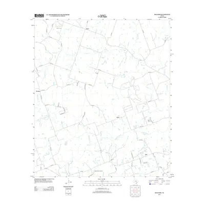
2012 Map of Beaukiss
USGS Topo · Published 2012About this map
The dispersed rural community of Beaukiss and the surrounding central Texas countryside are defined by a network of creeks and small family settlements. Low-lying drainages including Middle Yegua Cr, Cross Cr, and Knight Br carve through the landscape, which is marked by scattered agricultural operations and historical burial grounds such as Guentzel Cem and Burns Cem. The area maintains a traditional rural character, anchored by the crossroads at Adina, Shiloh, and Blue. Local aviation is represented by the Wood Triple D Airport, while energy extraction is evidenced by the Abbott Oil Field in the north. The terrain varies from the elevations of Clay Hill to the seasonal wetlands of Marshy Br, illustrating the typical hydrology of the Yegua Creek watershed before it reaches larger impoundments.
Find a feature on this map
70 named features on this map. Tap any name to fly to it.
Don’t see what you’re looking for? This feature index may not catch every label — zoom into the map to look around manually.
Map Details
Editions of this 2012 Beaukiss Map
This is the sole edition of this map. No revisions or reprints were ever made.
Other maps of this area

1885 · Taylor
USGS Topo · 1:125,000

1885 · Bastrop
USGS Topo · 1:125,000

1887 · Taylor
USGS Topo · 1:125,000

1893 · Bastrop
USGS Topo · 1:125,000

1894 · Taylor
USGS Topo · 1:125,000

1904 · Bastrop
USGS Topo · 1:125,000

1948 · Elgin
USGS Topo · 1:62,500

1948 · Lexington
USGS Topo · 1:62,500

1950 · Lexington
USGS Topo · 1:62,500

1950 · Elgin
USGS Topo · 1:62,500